
Dosiero:Canada (orthographic projection).svg

Grando de tiu PNG antaŭprezento de tiu SVGa dosiero: 541 × 541 rastrumeroj. Aliaj distingivoj: 240 × 240 rastrumeroj | 480 × 480 rastrumeroj | 768 × 768 rastrumeroj | 1 024 × 1 024 rastrumeroj | 2 048 × 2 048 rastrumeroj.
Bildo en pli alta difino (SVG-dosiero, 541 × 541 rastrumeroj, grandeco de dosiero: 487 KB)
| Jen dosiero de la Wikimedia-Komunejo. La priskribo en ties priskriba paĝo estas montrata suben.
|
Resumo
| Priskribo |
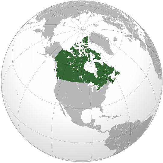
English: Map of Canada |
||||
| Dato | |||||
| Fonto |
Propra verko (Originala teksto: Own work, )
|
||||
| Aŭtoro | Ssolbergj | ||||
| Ceteraj versioj |
Derivaĵoj de ĉi tiu dosiero: Map of New Brunswck.png .svg)
|
||||
| SVG genesis |

.svg)
.svg)
.svg)
.svg)
.svg)
.svg)
.svg)
.svg)
.svg)
.svg)
.svg)
.svg)
.svg)
.svg)
.svg)
.svg)
.svg)
.svg)
.svg)
.svg)
.svg)
.svg)
.svg)
.svg)
.svg)
.svg)
.svg)
.svg)
.svg)
.svg)
.svg)
.svg)
.svg)
.svg)
.svg)
.svg)
.svg)
.svg)
.svg)
.svg)
.svg)
.svg)
.svg)
.svg)
.svg)
.svg)
.svg)
.svg)
.svg)
.svg)
.svg)
.svg)
.svg)
.svg)
.svg)
.svg)
.svg)
.svg)
.svg)
.svg)
.svg)
.svg)
.svg)
.svg)
.svg)
.svg)
.svg)
.svg)
.svg)
.svg)
.svg)
.svg)
.svg)

.svg)

.svg)

.svg)
.svg)
.svg)
.svg)
.svg)
.svg)
.svg)


.svg)
.svg)
.svg)
.svg)
.svg)
.svg)
.svg)

.svg)
.svg)
.svg)
.svg)
.svg)
.svg)
.svg)
.svg)
.svg)

.svg)
.svg)
.svg)
.svg)
.svg)
.svg)
.svg)
_without_national_boundaries.svg)
.svg)
.svg)
.svg)
.svg)
.svg)
.svg)

.svg)
.svg)
.png)
.svg)
.svg)
.svg)
.svg)

.svg)
.svg)
.svg)
.svg)
.svg)
.svg)
.svg)
.svg)
.svg)
.svg)
.svg)

.svg)
.svg)
.svg)
.svg)
.svg)
.svg)
.svg)
.svg)
.svg)

.svg)
.svg)

.svg)
.svg)
.svg)
.svg)
.svg)
.svg)
.svg)
.svg)
.svg)
.svg)
.svg)
.svg)
.svg)
.svg)
.svg)
.svg)
.svg)
.svg)
.svg)
.svg)
.svg)
.svg)
.svg)
.svg)
.svg)
.svg)
.svg)
_-_Crimea_disputed.svg)
.svg)
.svg)
.svg)
.svg)
.svg)
.svg)
.svg)
.svg)
.svg)
.svg)
.svg)
_political.svg)
.svg)
.svg)
.svg)
.svg)
_-_Crimea_disputed_-_no_borders.svg)
.svg)
.svg)
.svg)
.svg)
.svg)
.svg)
.svg)
.svg)
.svg)
.svg)
.svg)

.svg)
.svg)
.svg)

.png)
.svg)
.svg)
.svg)
.svg)
.svg)
.svg)
.svg)
.svg)
.svg)
.svg)
.svg)
.svg)
.svg)
.svg)
.svg)
.svg)
.svg)
.svg)
.svg)
.svg)
.svg)
.svg)
.svg)
.svg)
.svg)
.svg)
.svg)
.svg)
.svg)
.svg)
.svg)
.svg)
.svg)
.svg)
.png)
.svg)
.svg)
.svg)
_(orthographic_projection).png)
.svg)
.svg)
.svg)
Permesiloj:
Mi, la posedanto de la aŭtorrajto por ĉi tiu verko, ĉi-maniere publikigas tiun laŭ la jena permesilo:
|cc-by-3.0}}🐸
Dosierhistorio
Alklaku iun daton kaj horon por vidi kiel la dosiero tiam aspektis.
| Dato/Horo | Bildeto | Grandecoj | Uzanto | Komento | |
|---|---|---|---|---|---|
| nun | 17:00, 29 okt. 2008 | | 541 × 541 (487 KB) | Ssolbergj | {{Information |Description={{en|1=Map of Canada}} |Source=Own work by uploader |Author=Ssolbergj |Date=29 October 2008 |Permission= |other_versions= }} <!--{{ImageUpload|full}}--> Category:Orthographic projections [[Category:Ma |
Dosiera uzado
La jena paĝo ligas al ĉi tiu dosiero:
Suma uzado de la dosiero
La jenaj aliaj vikioj utiligas ĉi tiun dosieron:
- Uzado en ady.wikipedia.org
- Uzado en af.wikipedia.org
- Uzado en af.wiktionary.org
- Uzado en als.wikipedia.org
- Uzado en ang.wikipedia.org
- Uzado en arc.wikipedia.org
- Uzado en ar.wikipedia.org
- Uzado en as.wikipedia.org
- Uzado en az.wiktionary.org
- Uzado en bcl.wikipedia.org
- Uzado en be-tarask.wikipedia.org
- Uzado en beta.wikiversity.org
- Uzado en be.wikipedia.org
- Uzado en be.wiktionary.org
- Uzado en bg.wikipedia.org
- Uzado en bm.wikipedia.org
- Uzado en bo.wikipedia.org
- Uzado en br.wikipedia.org
- Uzado en ceb.wikipedia.org
- Uzado en chr.wikipedia.org
- Uzado en chy.wikipedia.org
- Uzado en ckb.wikipedia.org
- Uzado en crh.wikipedia.org
- Uzado en cs.wikipedia.org
- Uzado en cs.wikiquote.org
- Uzado en cu.wikipedia.org
- Uzado en cv.wikipedia.org
- Uzado en da.wikipedia.org
- Uzado en de.wikipedia.org
- Uzado en dv.wikipedia.org
- Uzado en el.wikipedia.org
- Uzado en eml.wikipedia.org
- Uzado en en.wikipedia.org
Vidi plian ĝeneralan uzadon de ĉi tiu dosiero.
.svg)
.svg)