
Dosiero:Quebec - Arrondissements.svg

Grando de tiu PNG antaŭprezento de tiu SVGa dosiero: 623 × 600 rastrumeroj. Aliaj distingivoj: 249 × 240 rastrumeroj | 498 × 480 rastrumeroj | 798 × 768 rastrumeroj | 1 063 × 1 024 rastrumeroj | 2 127 × 2 048 rastrumeroj | 1 133 × 1 091 rastrumeroj.
Bildo en pli alta difino (SVG-dosiero, 1 133 × 1 091 rastrumeroj, grandeco de dosiero: 26 KB)
| Jen dosiero de la Wikimedia-Komunejo. La priskribo en ties priskriba paĝo estas montrata suben.
|
Resumo
| Priskribo |
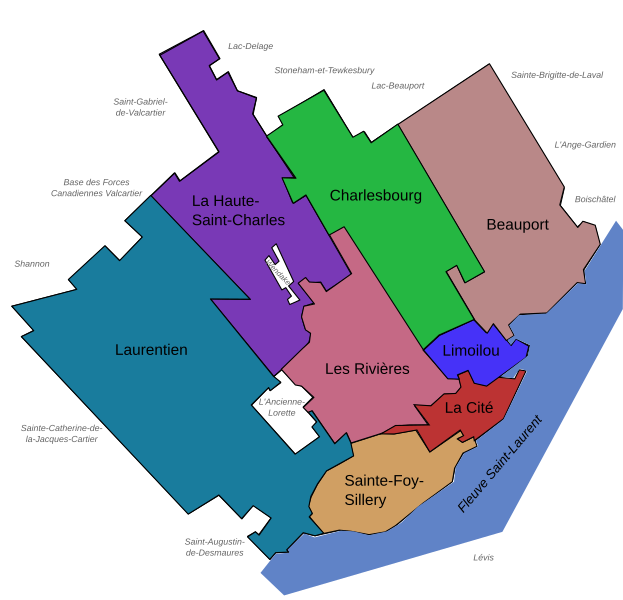
Français : Carte des arrondissements de la ville de Québec (Québec, Canada) en 2007.
English: Maps of the Boroughs ("Arrondissements") of Quebec City (Quebec, Canada), 2007. |
||
| Dato | |||
| Fonto | Own work, made with Inkscape | ||
| Aŭtoro | User:Boréal | ||
| Permeso (Reuzo de la dosiero) |
|
||
| Ceteraj versioj |
Version modifiée illustrant les arrondissements le 1er novembre 2009 Modified version illustrating the boroughs on November 1, 2009 |

Dosierhistorio
Alklaku iun daton kaj horon por vidi kiel la dosiero tiam aspektis.
| Dato/Horo | Bildeto | Grandecoj | Uzanto | Komento | |
|---|---|---|---|---|---|
| nun | 18:28, 16 maj. 2008 | | 1 133 × 1 091 (26 KB) | Essin | Spelling edit: Stoneham-et-Tewksbury -> Stoneham-et-Tewkesbury |
| 20:43, 9 dec. 2007 |  | 1 133 × 1 091 (26 KB) | Boréal | {{Information |Description= {{fr}} Carte des arrondissements de la ville de Québec (Québec, Canada) en 2007. {{en}} Maps of the Boroughs ("Arrondissements") of Quebec City (Quebec, Canada), 2007. |Source=Own work, made with Inkscape |Date=2007-12-09 |Au | |
| 20:35, 9 dec. 2007 |  | 1 133 × 1 091 (26 KB) | Boréal | {{Information |Description= {{fr}} Carte des arrondissements de la ville de Québec (Québec, Canada) en 2007. {{en}} Maps of the Boroughs ("Arrondissements") of Quebec City (Quebec, Canada), 2007. |Source=Own work, made with Inkscape |Date=2007-12-09 |Au | |
| 20:30, 9 dec. 2007 |  | 1 133 × 1 091 (25 KB) | Boréal | {{Information |Description= {{fr}} Carte des arrondissements de la ville de Québec (Québec, Canada) en 2007. {{en}} Maps of the Boroughs ("Arrondissements") of Quebec City (Quebec, Canada), 2007. |Source=Own work, made with Inkscape |Date=2007-12-09 |Au |
Dosiera uzado
La jena paĝo ligas al ĉi tiu dosiero:
Suma uzado de la dosiero
La jenaj aliaj vikioj utiligas ĉi tiun dosieron:
- Uzado en ar.wikipedia.org
- Uzado en de.wikipedia.org
- Uzado en en.wikipedia.org
- Uzado en fr.wikipedia.org
- Uzado en la.wikipedia.org
- Uzado en ru.wikipedia.org