
Dosiero:Antarctica map.jpg
Bildo en pli alta difino ((4 549 × 3 973 rastrumeroj, grandeco de dosiero: 6,18 MB, MIME-tipo: image/jpeg))
| Jen dosiero de la Wikimedia-Komunejo. La priskribo en ties priskriba paĝo estas montrata suben.
|
| Atentu | La originala dosiero havas multe da bilderoj, kaj lanĉi ĝin plen-distingive povus kaŭzi mis-ŝargon aŭ frostigon de retumilo. Tiujn problemojn oni povas eviti per uzado de ZoomViewer. |
|---|
| Eldonejo |
Justus Perthes |
||||
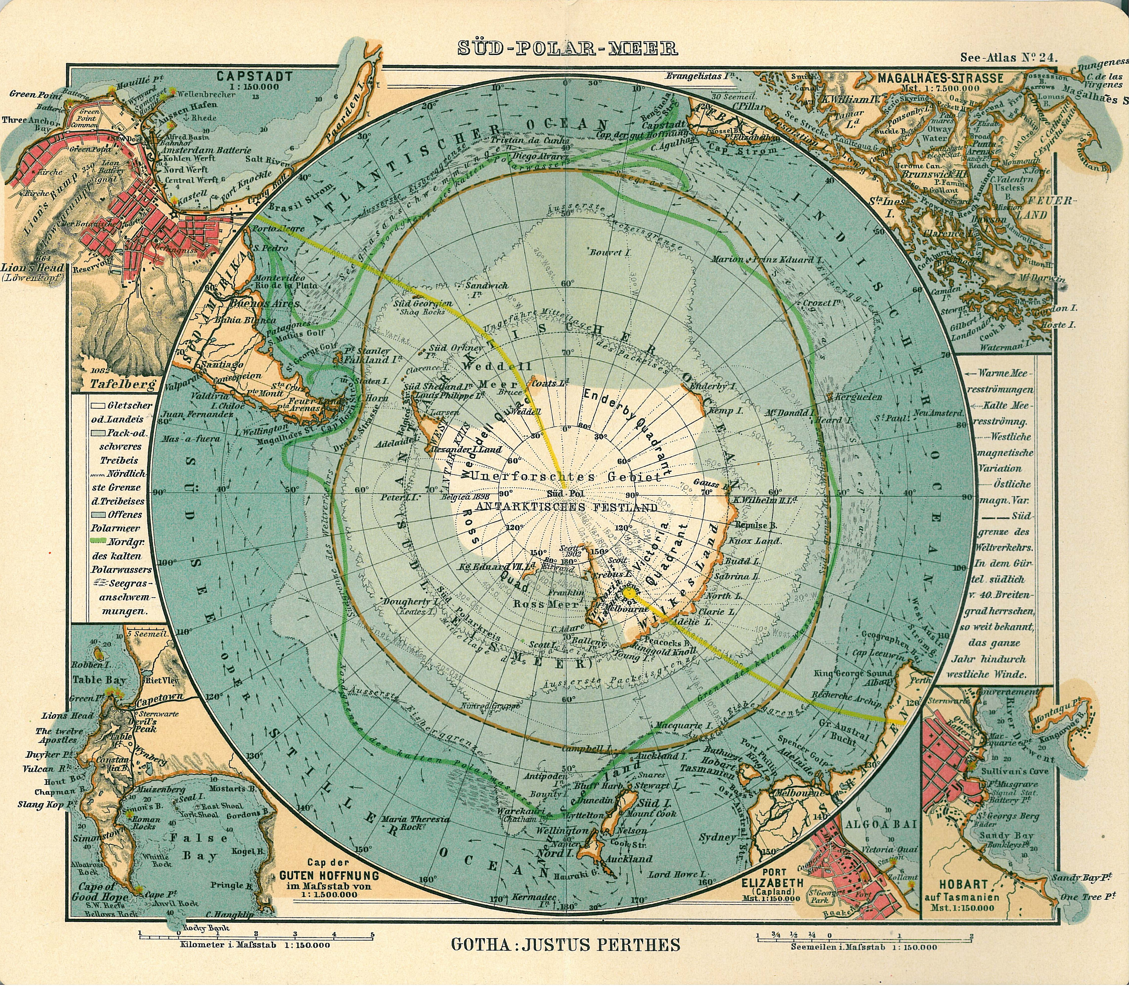
| Priskribo |
Deutsch: Blatt 24, Süd-Polar-Meer
English: Page 24, Antarctica, Inset maps of Cape town, Cape of good hope, Magalhaes strait, Hobart, Port Elizabeth |
||||
| Dato de eldono | 1906 | ||||
| Loko de eldonigo | Gotha | ||||
| Fonto | See Atlas | ||||
| Permeso (Reuzo de la dosiero) |
|
||||
.jpg)
Dosierhistorio
Alklaku iun daton kaj horon por vidi kiel la dosiero tiam aspektis.
| Dato/Horo | Bildeto | Grandecoj | Uzanto | Komento | |
|---|---|---|---|---|---|
| nun | 17:08, 15 jan. 2007 | | 4 549 × 3 973 (6,18 MB) | Martas011 | Category:Old maps of Antarctica Category:Maps of oceans Category:Maps of the Southern Ocean Good map of Antarctica, Justhus Perthes See Atlas 1906 Inset maps of Cape town, Cape of good hope, Magalhaes strait, Hobart, Port Elizabeth |
Dosiera uzado
La jena paĝo ligas al ĉi tiu dosiero:
Suma uzado de la dosiero
La jenaj aliaj vikioj utiligas ĉi tiun dosieron:
- Uzado en avk.wikipedia.org
- Uzado en ca.wikipedia.org
- Uzado en de.wikipedia.org
- Uzado en en.wikipedia.org
- Uzado en id.wikipedia.org
- Uzado en it.wikipedia.org
- Uzado en ja.wikipedia.org
- Uzado en nl.wikipedia.org
- Uzado en pl.wikipedia.org
- Uzado en pt.wikipedia.org
- Uzado en ru.wikipedia.org
- Uzado en zh.wikipedia.org