
Dosiero:Baldcypress range.jpg
Grandeco de ĉi antaŭvido: 457 × 600 rastrumeroj. Aliaj distingivoj: 183 × 240 rastrumeroj | 366 × 480 rastrumeroj | 640 × 840 rastrumeroj.
Bildo en pli alta difino ((640 × 840 rastrumeroj, grandeco de dosiero: 93 KB, MIME-tipo: image/jpeg))
| Jen dosiero de la Wikimedia-Komunejo. La priskribo en ties priskriba paĝo estas montrata suben.
|
Resumo
| Priskribo |
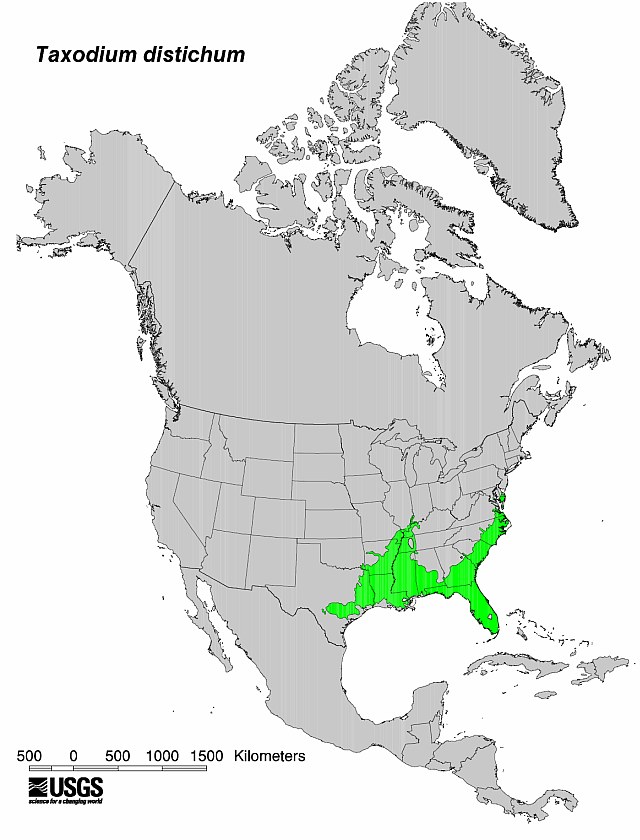
English: Flora distribution map Bald Cypress (Taxodium distichum) tree.
|
| Dato | No clue when it was produced by the USGS - I'm uploading it here 5/25/09 |
| Fonto | USGS |
| Aŭtoro | USGS |


Permesiloj:
This image is in the public domain in the United States because it only contains materials that originally came from the United States Geological Survey, an agency of the United States Department of the Interior. For more information, see the official USGS copyright policy.
|
Originala alŝutada protokolo
Transigita de en.wikipedia al Commons de Sreejithk2000 per CommonsHelper.
The original description page was here. All following user names refer to en.wikipedia.
- 2009-05-25 18:58 Nuberger13 640×840× (94968 bytes) {{Information |Description = Map showing the range of the baldcypress tree |Source = USGS |Date = No clue when it was produced by the USGS - I'm uploading it here 5/25/09 |Author = USGS |Permission = PD |other_versio
Dosierhistorio
Alklaku iun daton kaj horon por vidi kiel la dosiero tiam aspektis.
| Dato/Horo | Bildeto | Grandecoj | Uzanto | Komento | |
|---|---|---|---|---|---|
| nun | 07:47, 1 jun. 2010 | | 640 × 840 (93 KB) | File Upload Bot (Magnus Manske) | {{BotMoveToCommons|en.wikipedia|year={{subst:CURRENTYEAR}}|month={{subst:CURRENTMONTHNAME}}|day={{subst:CURRENTDAY}}}} {{Information |Description={{en|Map showing the range of the baldcypress tree}} |Source=Transferred from [http://en.wikipedia.org en.wi |
Dosiera uzado
La jena paĝo ligas al ĉi tiu dosiero:
Suma uzado de la dosiero
La jenaj aliaj vikioj utiligas ĉi tiun dosieron:
- Uzado en ceb.wikipedia.org
- Uzado en en.wikipedia.org
- Uzado en he.wikipedia.org
- Uzado en hu.wikipedia.org
- Uzado en is.wikipedia.org
- Uzado en lt.wikipedia.org
- Uzado en ru.wikipedia.org
- Uzado en war.wikipedia.org