
Dosiero:Chièvres Hainaut Belgium Map.png
Jen estas la maksimuma distingivo de la supra bildo.
Chièvres_Hainaut_Belgium_Map.png ((355 × 278 rastrumeroj, grandeco de dosiero: 8 KB, MIME-tipo: image/png))
| Jen dosiero de la Wikimedia-Komunejo. La priskribo en ties priskriba paĝo estas montrata suben.
|

|
File:Chièvres Hainaut Belgium Map.svg estas vektora versio de ĉi tiu bildo. Ĝi estu uzata anstataŭ ĉi tiu rastruma bildo, se ĝi ne estas malpli bonkvalita.
File:Chièvres Hainaut Belgium Map.png → File:Chièvres Hainaut Belgium Map.svg
Pliajn informojn vidu ĉe Help:SVG. |
 |
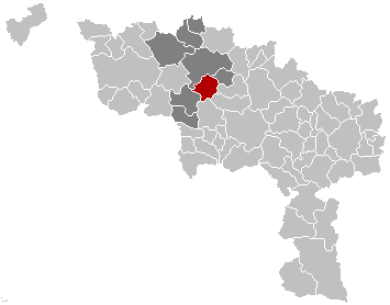
English: Map, municipality belgium Chièvres
Français : Carte indiquant la localisation de la commune de Chièvres dans la Province de Hainaut.
English: Map from w:nl:Gebruiker:LennartBolks/kaartenhoekje in Public Domain by the Author choice.
| Ĉi tiu verko estis liberigita kiel publika havaĵo de ties aŭtoro, LennartBolks. Tio aplikatas tutmonde. En iuj landoj tio povas esti laŭleĝe neebla; en tiu okazo: |
Dosierhistorio
Alklaku iun daton kaj horon por vidi kiel la dosiero tiam aspektis.
| Dato/Horo | Bildeto | Grandecoj | Uzanto | Komento | |
|---|---|---|---|---|---|
| nun | 13:12, 16 nov. 2008 | | 355 × 278 (8 KB) | Wester | {{Information |Description= |Source= |Date= |Author= |Permission= |other_versions= }} |
| 17:34, 25 maj. 2006 |  | 355 × 278 (8 KB) | Profoss | ||
| 21:36, 28 mar. 2005 |  | 355 × 278 (6 KB) | Nicnac25~commonswiki | Map, municipality belgium Chièvres {{PD}} FR; Carte indiquant la localisation de la commune de Chièvres dans la Province de Hainaut. EN; Map from w:nl:Gebruiker:LennartBolks/kaartenhoekje in Public Domain by the Author choice. [[Category:Maps of pr |
Dosiera uzado
Neniu paĝo ligas al ĉi tiu dosiero.