
Dosiero:Egypt Al Wadi al Jadid locator map.svg

Grando de tiu PNG antaŭprezento de tiu SVGa dosiero: 662 × 600 rastrumeroj. Aliaj distingivoj: 265 × 240 rastrumeroj | 530 × 480 rastrumeroj | 848 × 768 rastrumeroj | 1 130 × 1 024 rastrumeroj | 2 260 × 2 048 rastrumeroj | 1 055 × 956 rastrumeroj.
Bildo en pli alta difino (SVG-dosiero, 1 055 × 956 rastrumeroj, grandeco de dosiero: 351 KB)
| Jen dosiero de la Wikimedia-Komunejo. La priskribo en ties priskriba paĝo estas montrata suben.
|
Resumo
| Priskribo |
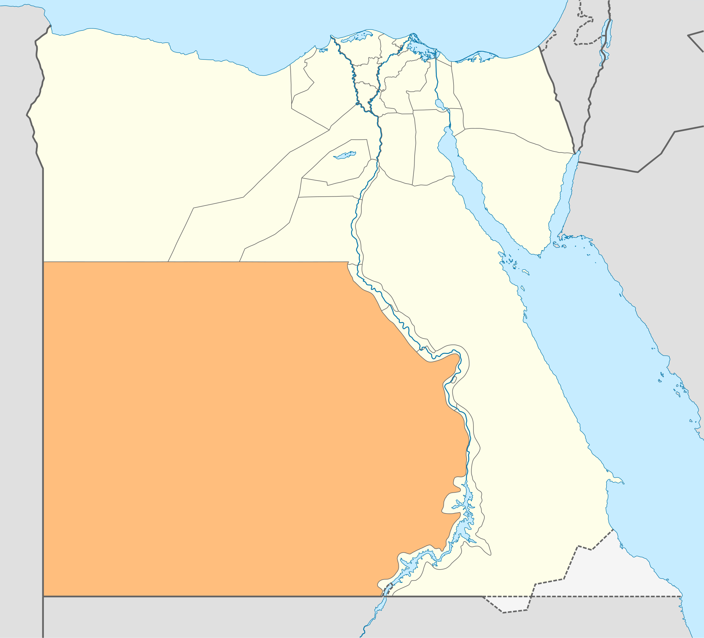
Deutsch: Lagekarte des Gouvernements New Valley—Al-Wadi al-dschadid in Ägypten
English: Locator Map of the New Valley Governorate of Egypt — the former Al Wadi al Jadid Governorate’’. |
| Dato | |
| Fonto | Propra verko |
| Aŭtoro | NordNordWest |
| Permeso (Reuzo de la dosiero) |
Mi, la posedanto de la aŭtorrajto por ĉi tiu verko, ĉi-maniere publikigas tiun laŭ la jena permesilo: Ĉi tiu dosiero estas disponebla laŭ la permesilo Krea Komunaĵo Atribuite-Samkondiĉe 3.0 Neadaptita.
|

|
This map has been made or improved in the German Kartenwerkstatt (Map Lab). You can propose maps to improve as well.
|
Dosierhistorio
Alklaku iun daton kaj horon por vidi kiel la dosiero tiam aspektis.
| Dato/Horo | Bildeto | Grandecoj | Uzanto | Komento | |
|---|---|---|---|---|---|
| nun | 16:21, 17 apr. 2011 | | 1 055 × 956 (351 KB) | NordNordWest | upd |
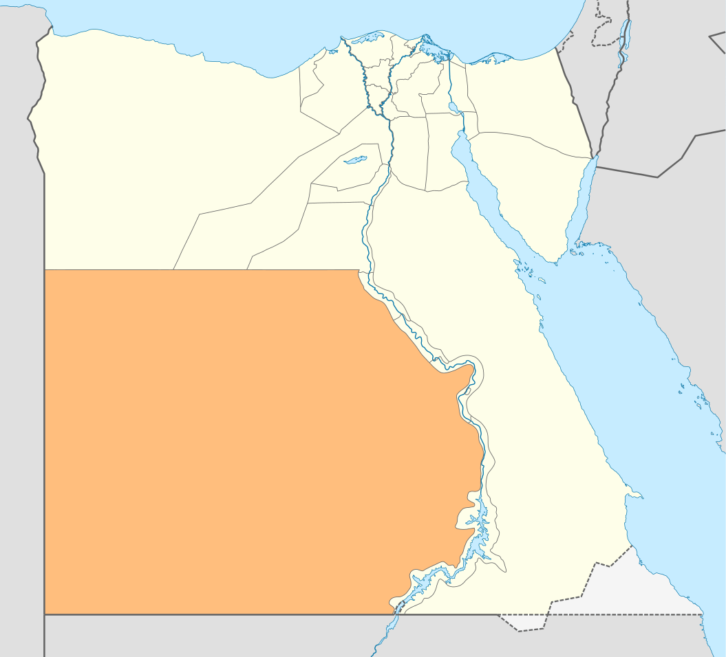
| 11:55, 3 sep. 2009 |  | 1 055 × 956 (560 KB) | NordNordWest | {{int:filedesc}} {{Information |Description= {{de|Lagekarte des Gouvernements Al-Wadi al-dschadid in Ägypten}} {{en|Locator map of the Al Wadi al Jadid Governorate in Egypt}} |Source={{Own}} |Date=2009-09-03 |Author={{U|NordNordWest}} |Permission={{self |
Dosiera uzado
Neniu paĝo ligas al ĉi tiu dosiero.
Suma uzado de la dosiero
La jenaj aliaj vikioj utiligas ĉi tiun dosieron:
- Uzado en bg.wikipedia.org
- Uzado en de.wikipedia.org
- Uzado en de.wikivoyage.org
- Bārīs
- ʿAin Muṣṭafā Kāschif
- ʿAin Schams ed-Dīn
- ʿAin Umm ed-Dabādīb
- Chārga
- Chārga (Stadt)
- Farāfra
- Farāfra (Stadt)
- Gabbānat el-Bagawāt
- Gāra (Neues Tal)
- Gebel eṭ-Ṭeir (el-Chārga)
- Qaṣr el-Ghuweiṭa
- Hībis
- Ismant
- Kristallberg (Libysche Wüste)
- Deir el-Munīra
- Nāḍūra
- Qaṣr Dūsch
- Qaṣr el-Labacha
- Qaṣr ez-Zaiyān
- Hassan Fathy Village (el-Chārga)
- ʿAin Manāwir
- Maks el-Qiblī
- Qilāʿ eḍ-Ḍabba
- Nationalpark Weiße Wüste
- ʿAin el-Wādī
- ʿAin Scheich Marzūq
- Abū Minqār
- ʿAin Bisāi
- ʿAin Gallaw
- Biʾr Dikkār
- ʿAin ed-Dālla
- Wādī el-Ubeiyiḍ
- Deir Abū Mattā
- Baschandī
- Qārat el-Muzawwaqa
- Qaṣr ed-Dāchla
- Deir el-Ḥagar
- Budchulū
- Dāchla
- Ḥalfat el-Biʾr
- Ismant el-Charāb
- Tineida
- ʿAin Aṣīl
- Balāṭ
- ʿAin Birbīya
- Qaṣaba
- Qalamūn (ed-Dāchla)
Vidi plian ĝeneralan uzadon de ĉi tiu dosiero.