
Dosiero:Admiralty Chart No 1723 The Houtman Rocks, Published 1845.jpg

Grandeco de ĉi antaŭvido: 800 × 596 rastrumeroj. Aliaj distingivoj: 320 × 239 rastrumeroj | 640 × 477 rastrumeroj | 1 024 × 763 rastrumeroj | 1 280 × 954 rastrumeroj | 2 560 × 1 909 rastrumeroj | 3 636 × 2 711 rastrumeroj.
Bildo en pli alta difino ((3 636 × 2 711 rastrumeroj, grandeco de dosiero: 1,11 MB, MIME-tipo: image/jpeg))
| Jen dosiero de la Wikimedia-Komunejo. La priskribo en ties priskriba paĝo estas montrata suben.
|
| Priskribo |
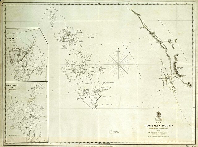
This is an image of British Admiralty Chart 1723, entitled "The Houtman Rocks". It shows an archipelago off the west coast of Australia now known as the Houtman Abrolhos. This map was published in 1845 based on a survey undertaken by John Clements Wickham and John Lort Stokes on board HMS Beagle in 1840. This is a scan of the copy belonging to the National Library of Australia (NLA). It has been slightly cropped, and colour balanced. |
|||
| Dato | The original map was published in 1845. | |||
| Fonto | Access to the original NLA scan is available at http://www.nla.gov.au/apps/cdview?pi=nla.map-t33-e. The graphical user interface provided does not support downloading the full image at full resolution, but the back end can be cajoled to do so by manually editing the CGI arguments in the url, to http://www.nla.gov.au/lizardtech/iserv/getimage?cat=NLAObjects&img=/nla.map/t/000/33/nla.map-t00033-sd.sid&oif=jpeg&rgn=0,0,1,1&cmd=zoomin&wid=3752&hei=2831. | |||
| Aŭtoro | John Clements Wickham, John Lort Stokes, British Admiralty. | |||
| Permeso (Reuzo de la dosiero) |
|

.jpg)
Dosierhistorio
Alklaku iun daton kaj horon por vidi kiel la dosiero tiam aspektis.
| Dato/Horo | Bildeto | Grandecoj | Uzanto | Komento | |
|---|---|---|---|---|---|
| nun | 00:43, 2 maj. 2008 | | 3 636 × 2 711 (1,11 MB) | Hesperian | {{Information |Description=This is an image of British Admiralty Chart 1723, entitled "The Houtman Rocks". It shows an archipelago off the west coast of Australia now known as the Houtman Abrolhos. This map was published in 1845 based on a survey |
Dosiera uzado
La jena paĝo ligas al ĉi tiu dosiero:
Suma uzado de la dosiero
La jenaj aliaj vikioj utiligas ĉi tiun dosieron:
- Uzado en de.wikipedia.org
- Uzado en en.wikipedia.org
- Uzado en gl.wikipedia.org
- Uzado en it.wikipedia.org
- Uzado en lt.wikipedia.org
- Uzado en nl.wikipedia.org
- Uzado en pl.wikipedia.org
- Uzado en www.wikidata.org