
Dosiero:Tropical Storm Zeta 2005.jpg
Bildo en pli alta difino ((4 800 × 4 800 rastrumeroj, grandeco de dosiero: 4,31 MB, MIME-tipo: image/jpeg))
| Jen dosiero de la Wikimedia-Komunejo. La priskribo en ties priskriba paĝo estas montrata suben.
|
Resumo
| Priskribo |
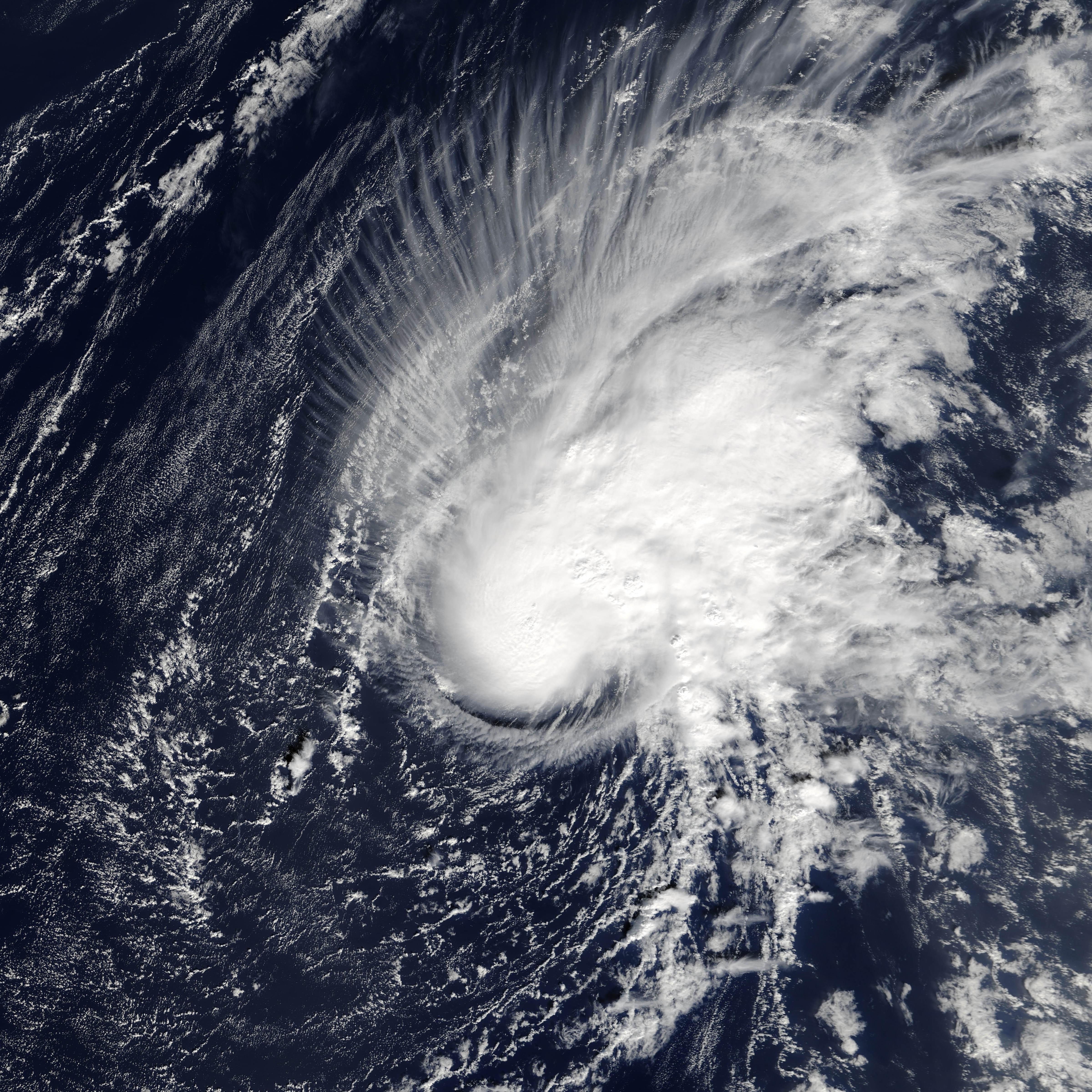
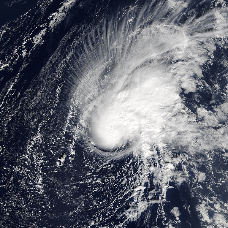
The 2005 Atlantic Hurricane season has been one of new records and surprises. December 30, 2005, saw yet another unexpected addition to the year’s weather events: Tropical Storm Zeta. The Moderate Resolution Imaging Spectroradiometer (MODIS) flying onboard the Terra satellite captured this image several days later on January 3, 2006, at 13:45 UTC (roughly 11:45 a.m. local time). At that time, Zeta still had sustained winds of around 100 kilometers per hour (63 miles per hour), a steady strength the storm has now maintained for several days, with a very slight increase in power. After the previous record-holding storm season of 1933, which saw 21 named storms, weather forecasters established a convention of using just 21 letters of the alphabet (the last letter being W) to begin the names of Atlantic tropical storms. After Hurricane Wilma in October 2005, forecasters turned to the Greek alphabet. Zeta is the sixth letter of that alphabet, and this is the 27th named storm of 2005. One month after 2005’s record-breaking storm season officially ended, this storm appeared roughly 1,600 kilometers (1,000 miles) to the southwest of the Azores Islands. A tropical storm is characterized by winds of at least 63 kilometers (39 miles) per hour. To be categorized as a hurricane, a storm needs winds of more than 119 kilometers (74 miles) per hour. As Tropical Storm Zeta formed, ocean temperatures didn’t appear warm enough to escalate Zeta into a hurricane, and news reports described it as no immediate threat to any land areas. |
|||||
| Dato | ||||||
| Fonto | http://earthobservatory.nasa.gov/NaturalHazards/natural_hazards_v2.php3?img_id=13300 | |||||
| Aŭtoro | NASA image courtesy Jeff Schmaltz, MODIS Rapid Response Team,Goddard Space Flight Center | |||||
| Permeso (Reuzo de la dosiero) |
|

Dosierhistorio
Alklaku iun daton kaj horon por vidi kiel la dosiero tiam aspektis.
| Dato/Horo | Bildeto | Grandecoj | Uzanto | Komento | |
|---|---|---|---|---|---|
| nun | 14:57, 3 aŭg. 2006 | | 4 800 × 4 800 (4,31 MB) | Good kitty | |
| 04:39, 6 jan. 2006 |  | 4 000 × 4 000 (3,12 MB) | AySz88 | Picture taken January 2, 2006 Picture from http://earthobservatory.nasa.gov/NaturalHazards/natural_hazards_v2.php3?img_id=13297 | |
| 23:31, 30 dec. 2005 |  | 1 024 × 1 024 (239 KB) | AySz88 | This image should be replaced by other, better images later. From The Naval Research Lab, http://www.nrlmry.navy.mil/tc-bin/tc_home2.cgi?&ACTIVES=05-ATL-30L.ZETA,05-SHEM-91S.INVEST&STORM=05-ATL-30L.ZETA&ATCF_BASIN=al&PHOT=yes&AGE=Prev&BASIN=ATL&STORM_NAM |
Dosiera uzado
La jena paĝo ligas al ĉi tiu dosiero:
Suma uzado de la dosiero
La jenaj aliaj vikioj utiligas ĉi tiun dosieron:
- Uzado en de.wikipedia.org
- Uzado en en.wikipedia.org
- Wikipedia:Selected anniversaries/December 30
- Portal:Tropical cyclones/Anniversaries/January
- Portal:Tropical cyclones/Anniversaries/January/6
- Portal:Tropical cyclones/Selected image/26
- Portal:Tropical cyclones/Featured article/Tropical Storm Zeta (2005)
- Tropical cyclones in 2005
- User:LightandDark2000/My Notable Storms
- User:40bus/sandbox1
- Portal:Tropical cyclones/Selected image
- Wikipedia:In the news/Posted/January 2006
- Uzado en es.wikipedia.org
- Uzado en eu.wikipedia.org
- Uzado en pt.wikipedia.org
- Uzado en simple.wikipedia.org
- Uzado en zh.wikipedia.org