
Dosiero:Betula papyrifera range map.jpg

Grandeco de ĉi antaŭvido: 800 × 599 rastrumeroj. Aliaj distingivoj: 320 × 240 rastrumeroj | 640 × 479 rastrumeroj | 1 024 × 767 rastrumeroj | 1 280 × 959 rastrumeroj | 2 435 × 1 824 rastrumeroj.
Bildo en pli alta difino ((2 435 × 1 824 rastrumeroj, grandeco de dosiero: 1,41 MB, MIME-tipo: image/jpeg))
| Jen dosiero de la Wikimedia-Komunejo. La priskribo en ties priskriba paĝo estas montrata suben.
|
Resumo
| Priskribo |
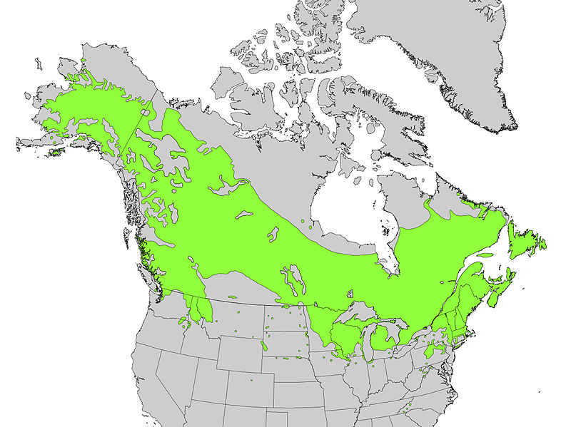
English: Range map of Betula papyrifera |
| Dato | |
| Fonto | Digital representation of "Atlas of United States Trees" by Elbert L. Little, Jr. [1] |
| Aŭtoro | U.S. Geological Survey |


Permesiloj:
This image is in the public domain in the United States because it only contains materials that originally came from the United States Geological Survey, an agency of the United States Department of the Interior. For more information, see the official USGS copyright policy.
|
Originala alŝutada protokolo
Transigita de en.wikipedia al Commons de Pinethicket per CommonsHelper.
The original description page was here. All following user names refer to en.wikipedia.
- 2012-09-30 13:25 Pinethicket 2435×1824× (1476581 bytes) {{Information |Description=Range map of ''Betula papyrifera'' |Source=Digital representation of "Atlas of United States Trees" by Elbert L. Little, Jr. [http://esp.cr.usgs.gov/data/atlas/little/] |Date=1999 |Author=U.S. Geological Survey ...
Dosierhistorio
Alklaku iun daton kaj horon por vidi kiel la dosiero tiam aspektis.
| Dato/Horo | Bildeto | Grandecoj | Uzanto | Komento | |
|---|---|---|---|---|---|
| nun | 08:58, 13 okt. 2012 | | 2 435 × 1 824 (1,41 MB) | File Upload Bot (Magnus Manske) | Transfered from en.wikipedia by User:Pinethicket using CommonsHelper |
Dosiera uzado
La jena paĝo ligas al ĉi tiu dosiero:
Suma uzado de la dosiero
La jenaj aliaj vikioj utiligas ĉi tiun dosieron:
- Uzado en ar.wikipedia.org
- Uzado en arz.wikipedia.org
- Uzado en be.wikipedia.org
- Uzado en ca.wikipedia.org
- Uzado en cs.wikipedia.org
- Uzado en eu.wikipedia.org
- Uzado en fa.wikipedia.org
- Uzado en hu.wikipedia.org
- Uzado en hy.wikipedia.org
- Uzado en sk.wikipedia.org
- Uzado en sv.wikipedia.org
- Uzado en tr.wikipedia.org
- Uzado en www.wikidata.org