
Dosiero:Odisha locator map.svg

Grando de tiu PNG antaŭprezento de tiu SVGa dosiero: 607 × 600 rastrumeroj. Aliaj distingivoj: 243 × 240 rastrumeroj | 486 × 480 rastrumeroj | 778 × 768 rastrumeroj | 1 037 × 1 024 rastrumeroj | 2 074 × 2 048 rastrumeroj | 2 269 × 2 241 rastrumeroj.
Bildo en pli alta difino (SVG-dosiero, 2 269 × 2 241 rastrumeroj, grandeco de dosiero: 211 KB)
| Jen dosiero de la Wikimedia-Komunejo. La priskribo en ties priskriba paĝo estas montrata suben.
|
| Titolo |
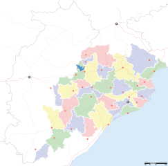
Orissa locator map |
||
| Priskribo |
Locator map for the Indian state of w:Orissa. Equirectangular projection - Geographic limits of the map: top=24.27, bottom=17.691 |
||
| Dato | |||
| Fonto |
Propra verko |
||
| Kreinto |
|
||
| Permeso (Reuzo de la dosiero) |
Mi, la posedanto de la aŭtorrajto por ĉi tiu verko, ĉi-maniere publikigas tiun laŭ la jena permesilo: Ĉi tiu dosiero estas disponebla laŭ la permesilo Krea Komunaĵo Atribuite-Samkondiĉe 3.0 Neadaptita.
|
||
| Geotemporal data | |||
| Montrata dato | dua duono de 20-a jarcento kaj 21-a jarcento | ||
| Georeferencing | If inappropriate please set warp_status = skip to hide. | ||
| Archival data | |||
| Notoj | Part of WikiProject India Maps | ||
Dosierhistorio
Alklaku iun daton kaj horon por vidi kiel la dosiero tiam aspektis.
| Dato/Horo | Bildeto | Grandecoj | Uzanto | Komento | |
|---|---|---|---|---|---|
| nun | 17:28, 6 sep. 2008 | | 2 269 × 2 241 (211 KB) | Planemad | |
| 13:28, 21 feb. 2008 |  | 647 × 564 (132 KB) | Mkeranat~commonswiki | {{Information |Description=Locator map for the state of [w:Orissa] updated to show white borders for districts |Source=self-made, based on India locator map by [w:User:Planemad] |Date=Feb 2008 |Author= Mkeranat |Permission= |other_versions= }} | |
| 21:32, 14 feb. 2008 |  | 647 × 564 (130 KB) | Mkeranat~commonswiki | {{Information |Description=Locator map for the state of [w:Orissa] |Source=self-made, based on India locator map by [w:User:Planemad] |Date=Feb 2008 |Author= Mkeranat |Permission= |other_versions= }} |
Dosiera uzado
Neniu paĝo ligas al ĉi tiu dosiero.
Suma uzado de la dosiero
La jenaj aliaj vikioj utiligas ĉi tiun dosieron:
- Uzado en ar.wikipedia.org
- Uzado en as.wikipedia.org
- Uzado en awa.wikipedia.org
- Uzado en ba.wikipedia.org
- Uzado en ceb.wikipedia.org
- Uzado en de.wikipedia.org
- Uzado en en.wikipedia.org
- Uzado en es.wikipedia.org
- Uzado en fa.wikipedia.org
- Uzado en gu.wikipedia.org
- Uzado en hi.wikipedia.org
- नलबण पक्षी अभयारण्य
- साँचा:ओड़िशा के लोकसभा निर्वाचन क्षेत्र
- आस्का लोक सभा निर्वाचन क्षेत्र
- भुवनेश्वर लोक सभा निर्वाचन क्षेत्र
- बलांगिर लोक सभा निर्वाचन क्षेत्र
- कटक लोक सभा निर्वाचन क्षेत्र
- ढेंकानाल लोक सभा निर्वाचन क्षेत्र
- जगतसिंहपुर लोक सभा निर्वाचन क्षेत्र
- जाजपुर लोक सभा निर्वाचन क्षेत्र
- कलाहांडी लोक सभा निर्वाचन क्षेत्र
- कंधमाल लोक सभा निर्वाचन क्षेत्र
Vidi plian ĝeneralan uzadon de ĉi tiu dosiero.