
Dosiero:Soho - map 1.png
Soho_-_map_1.png ((626 × 525 rastrumeroj, grandeco de dosiero: 422 KB, MIME-tipo: image/png))
| Jen dosiero de la Wikimedia-Komunejo. La priskribo en ties priskriba paĝo estas montrata suben.
|
| Priskribo |
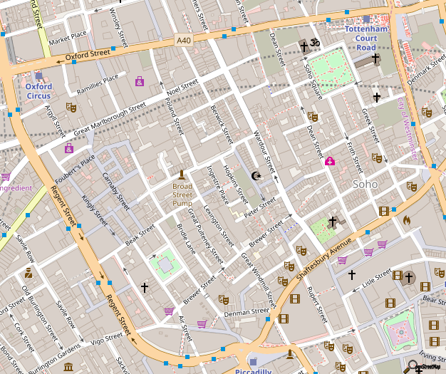
Map of Soho, London This map of London was created from OpenStreetMap project data, collected by the community. This map may be incomplete, and may contain errors. Don't rely solely on it for navigation. |
|||||||||
| Dato | ||||||||||
| Fonto | You may find a page on the OpenStreetMap wiki page for Soho | |||||||||
| Kreinto |
OpenStreetMap contributors |
|||||||||
| Permeso (Reuzo de la dosiero) |
OpenStreetMap data is available under the Open Database License (details). Map tiles are licensed under the Creative Commons Attribution-ShareAlike 2.0 license (CC-BY-SA 2.0).
Ĉi tiu dosiero estas disponebla laŭ la permesilo Krea Komunaĵo Atribuite-Samkondiĉe 2.0 Ĝenerala.
|
|||||||||
| Geotemporal data | ||||||||||
| Bounding box |
|
|||||||||
| Georeferencing | If inappropriate please set warp_status = skip to hide. | |||||||||
To see a more up-to-date OpenStreetMap view of this area: http://www.openstreetmap.org/#map=16/51.5129/-0.1343
...or generate this exact image: http://staticmap.openstreetmap.de/staticmap.php?center=51.5131,-0.13546&zoom=16&size=626x525
This map is available as SVG from the OpenStreetMap-Server however the file is 4.3MB big and uses 1.2GB of RAM for rendering in Inkscape 0.46, so it's better to keep this version. Here's the SVG link: http://tile.openstreetmap.org/cgi-bin/export?bbox=-0.14283,51.50958,-0.12871,51.51714&scale=6800&format=svg
Dosierhistorio
Alklaku iun daton kaj horon por vidi kiel la dosiero tiam aspektis.
| Dato/Horo | Bildeto | Grandecoj | Uzanto | Komento | |
|---|---|---|---|---|---|
| nun | 14:06, 29 okt. 2018 | | 626 × 525 (422 KB) | Wvdp | updates from osm |
| 18:05, 23 dec. 2017 |  | 626 × 525 (415 KB) | Wvdp | update | |
| 11:57, 2 nov. 2015 |  | 626 × 525 (396 KB) | FranklyMyDear... | Significant cartographic style change to the roads | |
| 21:55, 14 jul. 2015 |  | 626 × 525 (360 KB) | Harry Wood | update for 2015 with improved building coverage in the map data + more recent 'standard' OpenStreetMap style. Also "improving the resolution" back again closer to the native resolution | |
| 01:00, 5 jan. 2013 |  | 2 248 × 1 735 (2,12 MB) | John Aplessed | Improved resolution, updated design and contents, imaged zoomed out one level (original zoom level doesn't exist) | |
| 06:01, 9 jan. 2008 |  | 626 × 525 (151 KB) | Grenavitar | version without 401 label messed up | |
| 16:23, 18 dec. 2007 |  | 601 × 531 (145 KB) | IgnoredAmbience | ||
| 01:35, 27 feb. 2007 |  | 620 × 511 (65 KB) | Edward | {{Information |Description=Map of w:Soho |Source=OpenStreetMap |Date=2007-02-27 |Author=Edward Betts |Permission={{cc-by-sa-2.0}} }} Category:Maps of London Category:OpenStreetMap maps |
Dosiera uzado
La jena paĝo ligas al ĉi tiu dosiero:
Suma uzado de la dosiero
La jenaj aliaj vikioj utiligas ĉi tiun dosieron:
- Uzado en ar.wikipedia.org
- Uzado en be.wikipedia.org
- Uzado en bg.wikipedia.org
- Uzado en ceb.wikipedia.org
- Uzado en da.wikipedia.org
- Uzado en de.wikipedia.org
- Uzado en el.wikipedia.org
- Uzado en en.wikipedia.org
- Uzado en en.wikinews.org
- Uzado en fa.wikipedia.org
- Uzado en he.wikipedia.org
- Uzado en id.wikipedia.org
- Uzado en ja.wikipedia.org
- Uzado en km.wikipedia.org
- Uzado en kn.wikipedia.org
- Uzado en ko.wikipedia.org
- Uzado en no.wikipedia.org
- Uzado en pl.wikipedia.org
- Uzado en ru.wikipedia.org
- Uzado en simple.wikipedia.org
- Uzado en si.wikipedia.org
- Uzado en sk.wikipedia.org
- Uzado en sl.wikipedia.org
- Uzado en sr.wikipedia.org
- Uzado en te.wikipedia.org
- Uzado en tr.wikipedia.org
- Uzado en uk.wikipedia.org
- Uzado en war.wikipedia.org
- Uzado en www.wikidata.org
- Uzado en zh.wikipedia.org