
Dosiero:Amersfoort.png

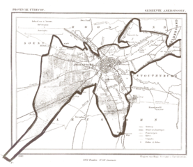
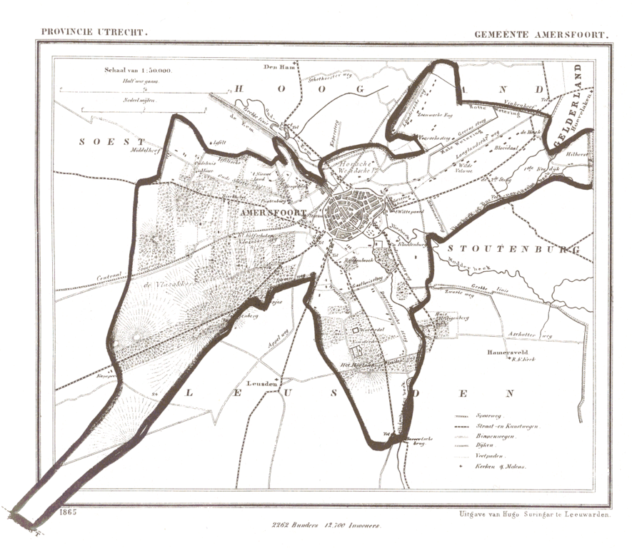
Grandeco de ĉi antaŭvido: 691 × 600 rastrumeroj. Aliaj distingivoj: 277 × 240 rastrumeroj | 553 × 480 rastrumeroj | 885 × 768 rastrumeroj | 1 180 × 1 024 rastrumeroj | 1 607 × 1 395 rastrumeroj.
Bildo en pli alta difino ((1 607 × 1 395 rastrumeroj, grandeco de dosiero: 248 KB, MIME-tipo: image/png))
| Jen dosiero de la Wikimedia-Komunejo. La priskribo en ties priskriba paĝo estas montrata suben.
|
Resumo
| Priskribo |
Nederlands: De naam van de website waar het vandaan kwam moet worden vermeld. De afbeelding komt van http://www.rat.de/kuijsten/atlas/ut/ . Het is de kaart van de gemeente nl:Amersfoort uit 1865.
The name of the website it came from must be used. This image came from: http://www.rat.de/kuijsten/atlas/ut/ . It is the map of gemeente nl:Amersfoort. |
| Dato | la 4-a de aprilo 2005 (origina alŝuta dato) |
| Fonto | Transigita de nl.wikipedia al Commons. Original source is http://www.rat.de/kuijsten/atlas/ut/. |
| Aŭtoro | La originala alŝutanto estis Jeroen de nederlanda Vikipedio |
Permesiloj:
This file is in the public domain because The name of the website it came from must be used. This image came from: http://www.rat.de/kuijsten/atlas/ut/ . It is the map of gemeente nl:Amersfoort.
|
Originala alŝutada protokolo
The original description page was here. All following user names refer to nl.wikipedia.
- 2005-04-04 00:39 Jeroen 1607×1395×4 (254150 bytes) {{beperkt}} Deze afbeelding kan alleen worden gebruikt op Wikipedia. De naam van de website waar het vandaan kwam moet worden vermeld. De afbeelding komt van http://www.rat.de/kuijsten/atlas/ut/ . Het is de kaart van de gemeente [[Amersfoort]]. This ima
Dosierhistorio
Alklaku iun daton kaj horon por vidi kiel la dosiero tiam aspektis.
| Dato/Horo | Bildeto | Grandecoj | Uzanto | Komento | |
|---|---|---|---|---|---|
| nun | 16:54, 14 mar. 2008 | | 1 607 × 1 395 (248 KB) | File Upload Bot (Magnus Manske) | {{BotMoveToCommons|nl.wikipedia}} {{Information |Description={{nl|De naam van de website waar het vandaan kwam moet worden vermeld. De afbeelding komt van http://www.rat.de/kuijsten/atlas/ut/ . Het is de kaart van de gemeente nl:Amersfoort. The nam |
Dosiera uzado
La jena paĝo ligas al ĉi tiu dosiero:
Suma uzado de la dosiero
La jenaj aliaj vikioj utiligas ĉi tiun dosieron:
- Uzado en fy.wikipedia.org
- Uzado en nds-nl.wikipedia.org