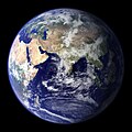
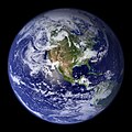
Dosiero:BlueMarble-2001-2002.jpg

Grandeco de ĉi antaŭvido: 800 × 400 rastrumeroj. Aliaj distingivoj: 320 × 160 rastrumeroj | 640 × 320 rastrumeroj | 1 024 × 512 rastrumeroj | 1 280 × 640 rastrumeroj | 2 560 × 1 280 rastrumeroj | 4 096 × 2 048 rastrumeroj.
Bildo en pli alta difino ((4 096 × 2 048 rastrumeroj, grandeco de dosiero: 1,22 MB, MIME-tipo: image/jpeg))
Dosierhistorio
Alklaku iun daton kaj horon por vidi kiel la dosiero tiam aspektis.
| Dato/Horo | Bildeto | Grandecoj | Uzanto | Komento | |
|---|---|---|---|---|---|
| nun | 22:14, 20 dec. 2009 |  | 4 096 × 2 048 (1,22 MB) | Apoc2400 | High resolution. |
| 02:10, 3 sep. 2005 |  | 405 × 203 (19 KB) | Saperaud~commonswiki | NASA created these two images to exhibit high-resolution global composites of Moderate Resolution Imaging Spectroradiometer [http://modarch.gsfc.nasa.gov (MODIS)] data. The land surface data were acquired from June through September of 2001. The clouds we |
Dosiera uzado
La jena paĝo ligas al ĉi tiu dosiero:
Suma uzado de la dosiero
La jenaj aliaj vikioj utiligas ĉi tiun dosieron:
- Uzado en af.wikipedia.org
- Uzado en ar.wikipedia.org
- Uzado en ast.wikipedia.org
- Uzado en az.wikipedia.org
- Uzado en ba.wikipedia.org
- Uzado en be.wikipedia.org
- Uzado en bh.wikipedia.org
- Uzado en bn.wikipedia.org
- Uzado en bo.wikipedia.org
- Uzado en bs.wikipedia.org
- Uzado en ca.wikipedia.org
- Uzado en cs.wikipedia.org
- Uzado en cy.wikipedia.org
- Uzado en da.wikipedia.org
- Uzado en de.wikipedia.org
- Uzado en diq.wikipedia.org
- Uzado en el.wikipedia.org
- Uzado en en.wikipedia.org
- Marine biology
- Environmental movement
- Environmental science
- Twin Earth thought experiment
- Underwater environment
- The Blue Marble
- Ecosystem diversity
- Habitable zone
- Environmental history
- Portal:Water
- Origin of water on Earth
- Portal:Marine life
- Portal:Environment
- Portal:Environment/Selected article
- Portal:Environment/Selected article/14
- Sea
- Talk:Sustainability/Archive 8
Vidi plian ĝeneralan uzadon de ĉi tiu dosiero.


