
Dosiero:LlanoEstacadoShadedRelief.jpg
Jen estas la maksimuma distingivo de la supra bildo.
LlanoEstacadoShadedRelief.jpg ((302 × 365 rastrumeroj, grandeco de dosiero: 32 KB, MIME-tipo: image/jpeg))
| Jen dosiero de la Wikimedia-Komunejo. La priskribo en ties priskriba paĝo estas montrata suben.
|


Resumo
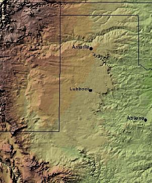
| Priskribo |
English: Shaded Relief Map of the Llano Estacado clipped from .pdf created by USGS National Map Viewer |
| Fonto |
http://nmviewogc.cr.usgs.gov/viewer.htm
|
| Aŭtoro |
Permesiloj:
This image is in the public domain in the United States because it only contains materials that originally came from the United States Geological Survey, an agency of the United States Department of the Interior. For more information, see the official USGS copyright policy.
|
Originala alŝutada protokolo
The original description page was here. All following user names refer to en.wikipedia.
Dosierhistorio
Alklaku iun daton kaj horon por vidi kiel la dosiero tiam aspektis.
| Dato/Horo | Bildeto | Grandecoj | Uzanto | Komento | |
|---|---|---|---|---|---|
| nun | 15:04, 26 dec. 2008 | | 302 × 365 (32 KB) | File Upload Bot (Magnus Manske) | {{BotMoveToCommons|en.wikipedia}} {{Information |Description={{en|Shaded Relief Map of the Llano Estacado clipped from .pdf created by USGS National Map Viewer http://nmviewogc.cr.usgs.gov/viewer.htm}} |Source=Transferred from [http://en.wikipedia.org en |
Dosiera uzado
La jena paĝo ligas al ĉi tiu dosiero:
Suma uzado de la dosiero
La jenaj aliaj vikioj utiligas ĉi tiun dosieron:
- Uzado en de.wikipedia.org
- Uzado en el.wikipedia.org
- Uzado en en.wikipedia.org
- Uzado en es.wikipedia.org
- Uzado en eu.wikipedia.org
- Uzado en fa.wikipedia.org
- Uzado en fr.wikipedia.org
- Uzado en fy.wikipedia.org
- Uzado en ja.wikipedia.org
- Uzado en kk.wikipedia.org
- Uzado en nl.wikipedia.org
- Uzado en no.wikipedia.org
- Uzado en pt.wikipedia.org
- Uzado en ro.wikipedia.org
- Uzado en ru.wikipedia.org
- Uzado en uk.wikipedia.org
- Uzado en uz.wikipedia.org
- Uzado en www.wikidata.org