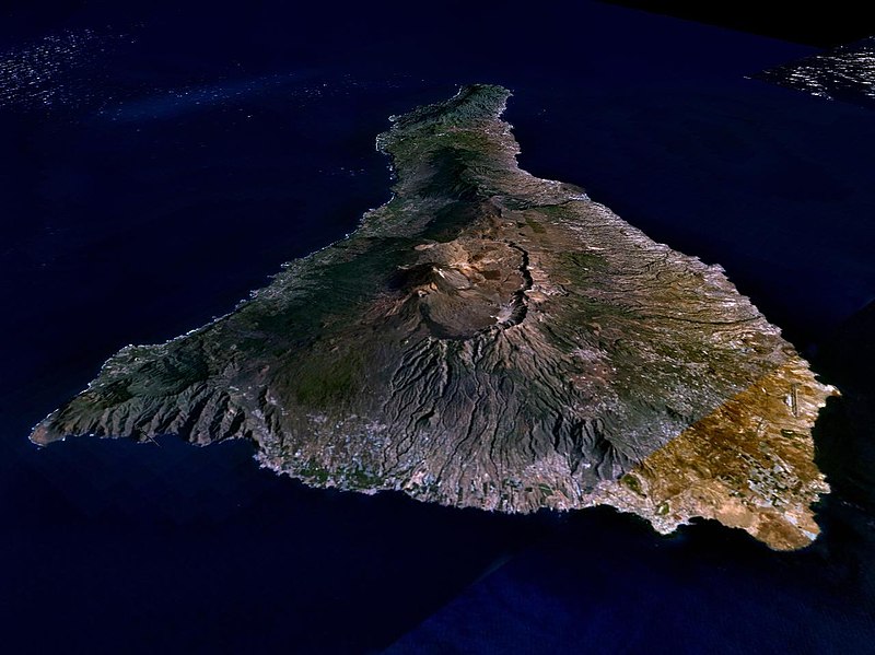
Dosiero:Nasa world wind - teneriffa.jpg

Grandeco de ĉi antaŭvido: 800 × 599 rastrumeroj. Aliaj distingivoj: 320 × 240 rastrumeroj | 640 × 479 rastrumeroj | 1 024 × 766 rastrumeroj | 1 280 × 958 rastrumeroj.
Bildo en pli alta difino ((1 280 × 958 rastrumeroj, grandeco de dosiero: 120 KB, MIME-tipo: image/jpeg))
Dosierhistorio
Alklaku iun daton kaj horon por vidi kiel la dosiero tiam aspektis.
| Dato/Horo | Bildeto | Grandecoj | Uzanto | Komento | |
|---|---|---|---|---|---|
| nun | 01:15, 31 mar. 2005 |  | 1 280 × 958 (120 KB) | Simplicius | {{NASA-PD}} Teneriffa from the west side. One sees Teide (3,700 meters) and the Caldera (2,000 m). To the right hand the new airport. On the left side one sees that there is more humidity and therefore vegetation at the north side of the island. |
Dosiera uzado
Suma uzado de la dosiero
La jenaj aliaj vikioj utiligas ĉi tiun dosieron:
- Uzado en ar.wikipedia.org
- Uzado en be-tarask.wikipedia.org
- Uzado en cs.wikipedia.org
- Uzado en de.wikipedia.org
- Uzado en de.wikinews.org
- Uzado en de.wikivoyage.org
- Uzado en en.wiktionary.org
- Uzado en es.wikipedia.org
- Uzado en fa.wikipedia.org
- Uzado en fi.wikipedia.org
- Uzado en frr.wikipedia.org
- Uzado en fy.wikipedia.org
- Uzado en gl.wikipedia.org
- Uzado en he.wikipedia.org
- Uzado en hu.wikipedia.org
- Uzado en incubator.wikimedia.org
- Uzado en it.wikipedia.org
- Uzado en mn.wikipedia.org
- Uzado en nn.wikipedia.org
- Uzado en no.wikipedia.org
- Uzado en pl.wiktionary.org
- Uzado en ru.wikipedia.org
- Uzado en sh.wikipedia.org
- Uzado en sk.wikipedia.org
- Uzado en sw.wikipedia.org
- Uzado en tr.wikipedia.org
- Uzado en uk.wikipedia.org
- Uzado en vi.wikivoyage.org
- Uzado en zgh.wikipedia.org

