
Dosiero:SG-Settlements.png

Grandeco de ĉi antaŭvido: 800 × 580 rastrumeroj. Aliaj distingivoj: 320 × 232 rastrumeroj | 640 × 464 rastrumeroj | 1 024 × 742 rastrumeroj | 1 280 × 928 rastrumeroj | 2 560 × 1 856 rastrumeroj | 3 702 × 2 684 rastrumeroj.
Bildo en pli alta difino ((3 702 × 2 684 rastrumeroj, grandeco de dosiero: 419 KB, MIME-tipo: image/png))
| Jen dosiero de la Wikimedia-Komunejo. La priskribo en ties priskriba paĝo estas montrata suben.
|
Resumo
| Priskribo |
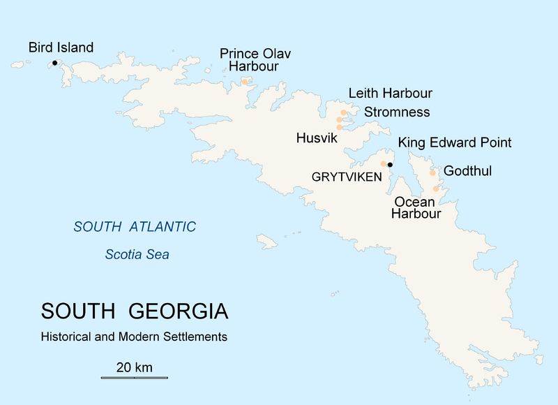
English: Map of South Georgia Island (Settlements) published by the author Apcbg. |
| Dato | |
| Fonto | Propra verko |
| Aŭtoro | Apcbg |
Permesiloj:
Mi, la posedanto de la aŭtorrajto por ĉi tiu verko, ĉi-maniere publikigas tiun laŭ la jena permesilo:

|
Estas permesite kopii, disdoni kaj/aŭ redakti ĉi tiun dokumenton, sen senŝanĝaj sekcioj, sen antaŭkovrilaj kaj sen dorskovrilaj tekstoj, laŭ la kondiĉoj de la Permesilo GNU por Liberaj Dokumentoj, Versio 1.2 aŭ ajna pli nova versio eldonita de la Free Software Foundation; sen Senŝanĝaj Sekcioj, Antaŭovrilaj Tekstoj aŭ Malantaŭkovrilaj Tekstoj. Kopio de la permesilo estas inkluzivita en la sekcio titolita GNU Free Documentation License. |
| Ĉi tiu dosiero estas disponebla laŭ la permesilo Krea Komunaĵo Atribuite-Samkondiĉe 3.0 Neadaptita. | ||
| ||
| Ĉi tiu permesila etikedo estis aldonita al la dosiero kiel parto de la permesila aktualigo por GFDL. |
Dosierhistorio
Alklaku iun daton kaj horon por vidi kiel la dosiero tiam aspektis.
| Dato/Horo | Bildeto | Grandecoj | Uzanto | Komento | |
|---|---|---|---|---|---|
| nun | 20:26, 18 nov. 2007 | | 3 702 × 2 684 (419 KB) | Apcbg | {{Information |Description=Map of South Georgia Island (Settlements) published by the author Apcbg. |Source=self-made |Date=18 November 2007 |Author= Apcbg }} == Licensing == {{self|GFDL}} |
| 20:16, 18 nov. 2007 |  | 3 702 × 2 684 (419 KB) | Apcbg | {{Information |Description=Map of South Georgia Island (Settlements) published by the author Apcbg. |Source=self-made |Date=18 November 2007 |Author= Apcbg }} == Licensing == {{self|GFDL}} | |
| 18:23, 18 nov. 2007 |  | 3 702 × 2 684 (419 KB) | Apcbg | {{Information |Description=Map of South Georgia Island (Settlements) published by the author Apcbg. |Source=self-made |Date=18 November 2007 |Author= Apcbg }} == Licensing == {{self|GFDL}} | |
| 11:00, 7 okt. 2007 |  | 2 962 × 1 952 (164 KB) | Apcbg | {{Information |Description=Map of South Georgia Island (Settlements) published by the author Apcbg. |Source=self-made |Date=7 October 2007 |Author= Apcbg }} == Licensing == {{self|GFDL}} | |
| 10:32, 7 okt. 2007 |  | 2 962 × 1 952 (164 KB) | Apcbg | {{Information |Description=Map of South Georgia Island (Settlements) published by the author Apcbg. |Source=self-made |Date=7 October 2007 |Author= Apcbg }} == Licensing == {{self|GFDL}} | |
| 08:42, 7 okt. 2007 |  | 2 962 × 1 952 (163 KB) | Apcbg | {{Information |Description=Map of South Georgia Island (Settlements) published by the author Apcbg. |Source=self-made |Date=7 October 2007 |Author= Apcbg }} == Licensing == {{self|GFDL}} | |
| 21:55, 5 okt. 2007 |  | 2 962 × 1 952 (16,57 MB) | Apcbg | {{Information |Description=Map of South Georgia Island (Settlements) published by the author Apcbg. |Source=self-made |Date=5 October 2007 |Author= Apcbg }} == Licensing == {{self|GFDL}} | |
| 21:36, 5 okt. 2007 |  | 2 962 × 1 952 (211 KB) | Apcbg | {{Information |Description=Map of South Georgia Island (Settlements) published by the author Apcbg. |Source=self-made |Date=5 October 2007 |Author= Apcbg }} == Licensing == {{self|GFDL}} |
Dosiera uzado
La jenaj paĝoj ligas al ĉi tiu dosiero:
Suma uzado de la dosiero
La jenaj aliaj vikioj utiligas ĉi tiun dosieron:
- Uzado en af.wikipedia.org
- Uzado en ar.wikipedia.org
- Uzado en bg.wikipedia.org
- Uzado en bs.wikipedia.org
- Uzado en ca.wikipedia.org
- Uzado en de.wikipedia.org
- Uzado en el.wikipedia.org
- Uzado en en.wikipedia.org
- South Georgia and the South Sandwich Islands
- Grytviken
- South Georgia
- King Edward Point
- Bird Island, South Georgia
- History of South Georgia and the South Sandwich Islands
- Leith Harbour
- Solveig Gunbjørg Jacobsen
- Prince Olav Harbour
- Godthul
- Ocean Harbour
- Invasion of South Georgia
- Reindeer in South Georgia
- List of settlements in South Georgia and the South Sandwich Islands
- Uzado en es.wikipedia.org
- Uzado en et.wikipedia.org
- Uzado en fa.wikipedia.org
- Uzado en fi.wikipedia.org
- Uzado en fr.wikipedia.org
- Uzado en fy.wikipedia.org
- Uzado en gd.wikipedia.org
- Uzado en gl.wikipedia.org
- Uzado en he.wikipedia.org
- Uzado en hu.wikipedia.org
- Uzado en id.wikipedia.org
- Uzado en incubator.wikimedia.org
- Uzado en is.wikipedia.org
- Uzado en it.wikipedia.org
Vidi plian ĝeneralan uzadon de ĉi tiu dosiero.