
Dosiero:Un-ethiopia.png
Bildo en pli alta difino ((3 038 × 2 257 rastrumeroj, grandeco de dosiero: 1,6 MB, MIME-tipo: image/png))
| Jen dosiero de la Wikimedia-Komunejo. La priskribo en ties priskriba paĝo estas montrata suben.
|
Resumo
| Priskribo |
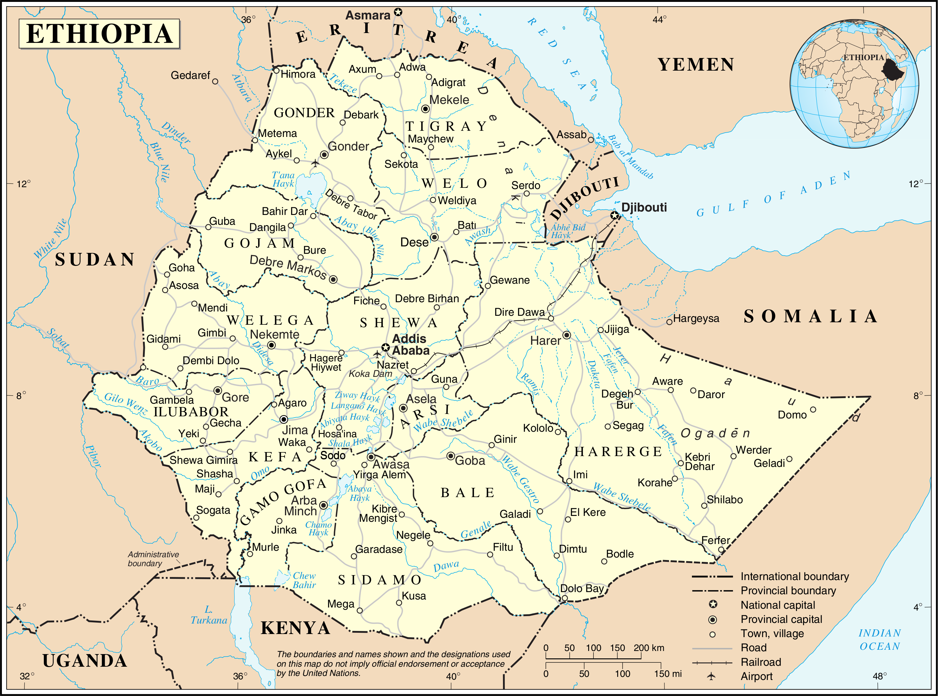
English: This map is not up to date. The internal borders show the provinces which were replaced by regions/states in 1995.
Nederlands: Deze kaart is verouderd. De interne grenzen tonen de provincies die in 1995 werden vervangen door regio's/staten. |
|||
| Dato | ||||
| Fonto | The United Nations Cartographic Section (UNCS) | |||
| Aŭtoro | Cartographer of the United Nations | |||
| Permeso (Reuzo de la dosiero) |
|

Dosierhistorio
Alklaku iun daton kaj horon por vidi kiel la dosiero tiam aspektis.
| Dato/Horo | Bildeto | Grandecoj | Uzanto | Komento | |
|---|---|---|---|---|---|
| nun | 01:00, 24 okt. 2007 | | 3 038 × 2 257 (1,6 MB) | Jeroen | {{UN map}} Category:Maps of Ethiopia |
Dosiera uzado
La jena paĝo ligas al ĉi tiu dosiero:
Suma uzado de la dosiero
La jenaj aliaj vikioj utiligas ĉi tiun dosieron:
- Uzado en ca.wikipedia.org
- Uzado en ckb.wikipedia.org
- Uzado en en.wikipedia.org
- Uzado en fa.wikipedia.org
- Uzado en fr.wikipedia.org
- Uzado en id.wikipedia.org
- Uzado en mzn.wikipedia.org
- Uzado en nl.wikipedia.org
- Uzado en pl.wiktionary.org
- Uzado en uk.wikipedia.org
- Uzado en ur.wikipedia.org
- Uzado en vi.wikipedia.org
- Uzado en www.wikidata.org