
Dosiero:Weston-super-maremap 1946.jpg
Grandeco de ĉi antaŭvido: 800 × 394 rastrumeroj. Aliaj distingivoj: 320 × 158 rastrumeroj | 640 × 315 rastrumeroj | 1 024 × 504 rastrumeroj | 1 687 × 831 rastrumeroj.
Bildo en pli alta difino ((1 687 × 831 rastrumeroj, grandeco de dosiero: 1,06 MB, MIME-tipo: image/jpeg))
| Jen dosiero de la Wikimedia-Komunejo. La priskribo en ties priskriba paĝo estas montrata suben.
|
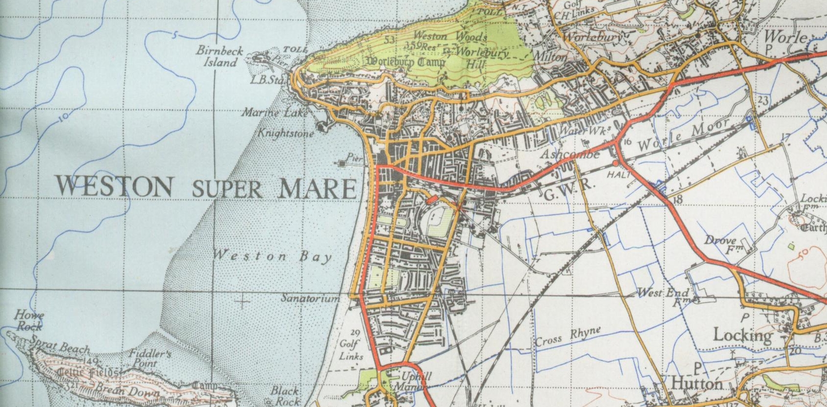
| Priskribo | Map of Weston-super-Mare from 1946 1 inch to the mile new popular edition |
| Dato | |
| Fonto | OS |
| Aŭtoro | OS |
This work is an Ordnance Survey map over 50 years old, which is covered by Crown Copyright which in this case expires 50 years after publication. Ordnance Survey does however ask that they be credited and that the date of publication be given.
Any ancillary rights gained through the creation of the electronic version are granted as freely usable under any circumstances.
|
This work created by the United Kingdom Government is in the public domain.
This is because it is one of the following:
HMSO has declared that the expiry of Crown Copyrights applies worldwide (ref: HMSO Email Reply)
|
 |
| Pozicio de la fotilo | | Tiu cxi bildo kaj pliaj sur OpenStreetMap |
|---|
Dosierhistorio
Alklaku iun daton kaj horon por vidi kiel la dosiero tiam aspektis.
| Dato/Horo | Bildeto | Grandecoj | Uzanto | Komento | |
|---|---|---|---|---|---|
| nun | 20:48, 1 mar. 2008 | | 1 687 × 831 (1,06 MB) | Geni | {{Information |Description=Map of Weston-super-Mare from 1946 1 inch to the mile new popular edition |Source=OS |Date=1946 |Author=OS |Permission=none needed |other_versions= }} Category:Weston-super-Mare {{oldOS}} |
Dosiera uzado
La jena paĝo ligas al ĉi tiu dosiero: