
Dosiero:Wolf-River-swamp-North-Mississippi.jpg

Grandeco de ĉi antaŭvido: 799 × 310 rastrumeroj. Aliaj distingivoj: 320 × 124 rastrumeroj | 640 × 248 rastrumeroj | 1 024 × 397 rastrumeroj | 1 280 × 497 rastrumeroj | 2 981 × 1 157 rastrumeroj.
Bildo en pli alta difino ((2 981 × 1 157 rastrumeroj, grandeco de dosiero: 2,58 MB, MIME-tipo: image/jpeg))
| Jen dosiero de la Wikimedia-Komunejo. La priskribo en ties priskriba paĝo estas montrata suben.
|
Resumo
| Priskribo |
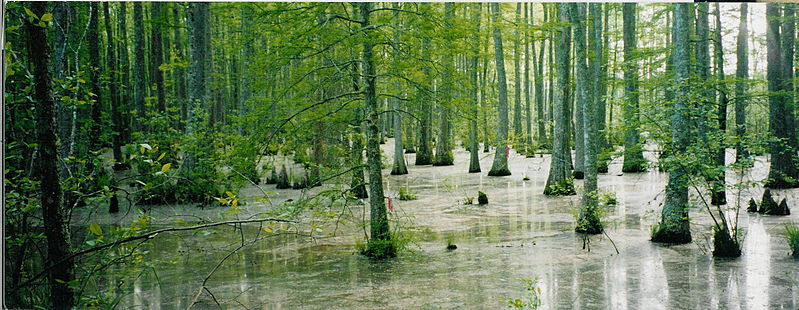
English: Bottomland hardwood swamp at the confluence of Tubby Creek and the Wolf River in the Holly Springs National Forest near Ashland, Mississippi.
|
| Dato | |
| Fonto | Propra verko |
| Aŭtoro | Gary Bridgman |
Permesiloj:
Mi, la posedanto de la aŭtorrajto por ĉi tiu verko, ĉi-maniere publikigas tiun laŭ la jena permesilo:

|
Estas permesite kopii, disdoni kaj/aŭ redakti ĉi tiun dokumenton, sen senŝanĝaj sekcioj, sen antaŭkovrilaj kaj sen dorskovrilaj tekstoj, laŭ la kondiĉoj de la Permesilo GNU por Liberaj Dokumentoj, Versio 1.2 aŭ ajna pli nova versio eldonita de la Free Software Foundation; sen Senŝanĝaj Sekcioj, Antaŭovrilaj Tekstoj aŭ Malantaŭkovrilaj Tekstoj. Kopio de la permesilo estas inkluzivita en la sekcio titolita GNU Free Documentation License. |
| Ĉi tiu dosiero estas disponebla laŭ la permesilo Krea Komunaĵo Atribuite-Samkondiĉe 3.0 Neadaptita. | ||
| ||
| Ĉi tiu permesila etikedo estis aldonita al la dosiero kiel parto de la permesila aktualigo por GFDL. |
Dosierhistorio
Alklaku iun daton kaj horon por vidi kiel la dosiero tiam aspektis.
| Dato/Horo | Bildeto | Grandecoj | Uzanto | Komento | |
|---|---|---|---|---|---|
| nun | 18:30, 4 apr. 2007 | 2 981 × 1 157 (2,58 MB) | Bridgman | {{Information |Description=Bottomland hardwood swamp at the confluence of Tubby Creek and the Wolf River in the Holly Springs National Forest near Ashland, Mississippi. The ribbons were used for navigation purposes by members of the Wolf River Conservancy |
Dosiera uzado
Neniu paĝo ligas al ĉi tiu dosiero.
Suma uzado de la dosiero
La jenaj aliaj vikioj utiligas ĉi tiun dosieron:
- Uzado en ar.wikipedia.org
- Uzado en arz.wikipedia.org
- Uzado en ceb.wikipedia.org
- Uzado en cy.wikipedia.org
- Uzado en de.wikipedia.org
- Uzado en en.wikipedia.org
- Uzado en es.wikipedia.org
- Uzado en fi.wikipedia.org
- Uzado en fo.wikipedia.org
- Uzado en fr.wikipedia.org
- Uzado en fy.wikipedia.org
- Uzado en incubator.wikimedia.org
- Uzado en ja.wikipedia.org
- Uzado en sv.wikipedia.org
- Uzado en vi.wikipedia.org
- Uzado en www.wikidata.org