
Dosiero:The Internal Revenue Service Building, located in the center of the Federal Triangle complex in Washington, D.C LCCN2013634106.tif

Grando de tiu JPG antaŭprezento de tiu TIFa dosiero: 800 × 386 rastrumeroj. Aliaj distingivoj: 320 × 154 rastrumeroj | 640 × 309 rastrumeroj | 1 024 × 494 rastrumeroj | 1 280 × 617 rastrumeroj | 2 560 × 1 234 rastrumeroj | 7 360 × 3 549 rastrumeroj.
Bildo en pli alta difino ((7 360 × 3 549 rastrumeroj, grandeco de dosiero: 149,5 MB, MIME-tipo: image/tiff))
| Jen dosiero de la Wikimedia-Komunejo. La priskribo en ties priskriba paĝo estas montrata suben.
|
Resumo
| Priskribo |
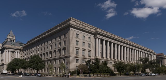
English: Title: The Internal Revenue Service Building, located in the center of the Federal Triangle complex in Washington, D.C
Physical description: 1 photograph : digital, tiff file, color. Notes: Built between 1928-1936 by architect Louis Simon.; Photographed as part of an assignment for the General Services Administration.; Title, date and keywords from information provided by the photographer.; Forms part of: Photographs in the Carol M. Highsmith Archive.; Gift; Carol M. Highsmith; 2009; (DLC/PP-2009:083).; Credit line: Photographs in the Carol M. Highsmith Archive, Library of Congress, Prints and Photographs Division. |
||||||||||||||||||||||||||
| Dato | |||||||||||||||||||||||||||
| Fonto |
Library of Congress
|
||||||||||||||||||||||||||
| Aŭtoro |
|
||||||||||||||||||||||||||
| Permeso (Reuzo de la dosiero) |
No known restrictions on publication.
|
||||||||||||||||||||||||||


| Pozicio de la fotilo | | Tiu cxi bildo kaj pliaj sur OpenStreetMap |
|---|
Permesiloj:
| This work is from the Carol M. Highsmith Archive collection at the Library of Congress. According to the library, there are no known copyright restrictions on the use of this work. Carol M. Highsmith has stipulated that her photographs are in the public domain. Photographs of sculpture or other works of art may be restricted by the copyright of the artist. |
 |
Dosierhistorio
Alklaku iun daton kaj horon por vidi kiel la dosiero tiam aspektis.
| Dato/Horo | Bildeto | Grandecoj | Uzanto | Komento | |
|---|---|---|---|---|---|
| nun | 05:25, 25 sep. 2016 |  | 7 360 × 3 549 (149,5 MB) | Fæ | LOC 2013634106, Carol M. Highsmith collection. P5840.20644 TIFF (149.5mb) |
Dosiera uzado
La jena paĝo ligas al ĉi tiu dosiero:
Suma uzado de la dosiero
La jenaj aliaj vikioj utiligas ĉi tiun dosieron:
- Uzado en ar.wikipedia.org
- Uzado en ca.wikipedia.org
- Uzado en en.wikipedia.org
- Uzado en es.wikipedia.org
- Uzado en he.wikipedia.org
- Uzado en io.wikipedia.org
- Uzado en ru.wikipedia.org
- Uzado en tr.wikipedia.org
- Uzado en www.wikidata.org
- Uzado en zh.wikipedia.org